When the suburb of Grandview was first surveyed and laid out for planning, the area within the core boundaries of Clark Drive (west), Hastings Street (north), Nanaimo Street (east), and Broadway (south) was divided into surveyors’ blocks, each with a unique legal designation. Grandview, at that time on the very edge of the new Vancouver, was made up of small urban blocks (north, west) and larger rural blocks (south, east), as follows:
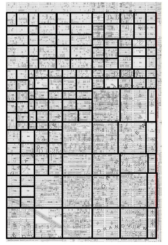
The Grandview Database uses this structure for sorting, and it proves useful as a tool to visualise certain data geographically. For example, the Database now includes a vast amount of data extracted from the 1921 Canada Census. Using this data within the block structure allows us to show how the total population of core Grandview — 10,270 persons counted — was distributed across the district.

In the weeks ahead, we will be publishing more of these maps using 1921 Census data. We hope you find them useful and of interest. Your comments are always welcomed.

Fantastic, thank you!
LikeLike