A group of us were at Zawa’s the other night, after the Heritage Awards, relaxing over food and beers, when the conversation turned to the short one-storey flat-roofed building that sat at Commercial & Venables until it burned down at the end of the 1990s. It seemed that most of us had memories of one store or another that had done business in those four storefronts: Everbest Grocery, Master Tailor, Grape Escape, the conctionery store that had twelve owners in its first twenty years, and many more, including cafes, furniture stores and political hang-outs..
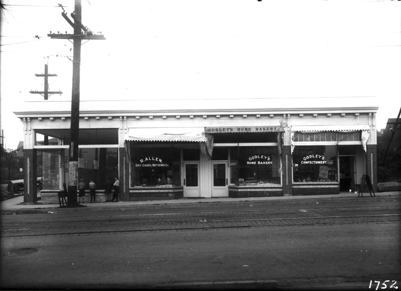 That got me remembering the problem of dates. There was an assumption that the building had been erected in 1907. However, I was never sure of that date. There had been no entries for any buildings at that end of the block until 1923, when they all suddenly appear at once. A more logical suggestion is that the building was erected in 1922 ready for full occupation by the following year. It has the appearance of similar buildings erected by Angus Campbell up and down the Drive in the late 1920s and 1930s, but I am not sure exactly who built this one. The image above is dated 1922 by City Archives.
Just today it occured to me to look at Goad’s map from December 1911,
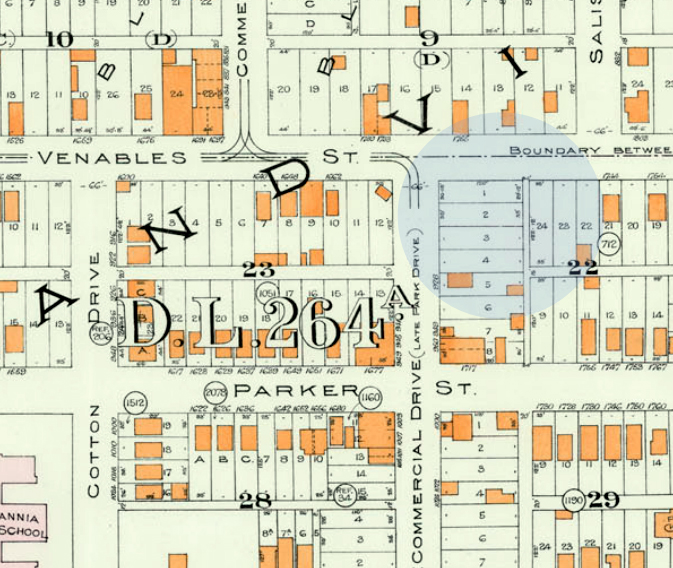
And the evidence is plain, there were no buildings in that entire quadrant of Block 22 in December 1911. Thus, the 1907 building date previously accepted by most of us appears to be inaccurate. I am not aware of any later photographs that could prove the case, but I strongly suspect that those first four lots on Commercial remained vacant until 1922.
Another brick in the wall of Grandview history.
Many thanks to Patrick at Heritage Vancouver for wading through his pile of water permits!

What is the source for a date of 1907 for this address, 900 Park Drive? Was it the water permit? There probably was a building permit circa 1910 (Patrick?) because my Oct 1910 fire insurance atlas shows a building under construction at that site. The dotted building footprint covers the full width of lot 1 and 2 of block 22 and is labelled “Excavation Oct 1910.” Perhaps the owner did not have a building permit and was prevented from finishing the building (?)
LikeLike
I would assume that last part is true, Bruce, given the vacant lot shown in the 1911 map. The person listed as having a water permit in 1907 (A.F. Arnold) in fact was building on the west side.
LikeLike
Only a temporary brick wall…
LikeLike