A month ago, I posted about the housing and land value collapse during the Depression and the lead up to World War Two. Thanks to the contunued diligent work of my colleague Donato Calogero, we now have a second set of data from property tax registers. This one illustrates the rapid increase in land and property values in the period 1948-1955.
The data this time covers Block 60 in District Lot 264a, a residential block enclosed by Clark drive, Graveley Street, McLean Drive and E. 1st Avenue. It contains 24 lots, of which 9 were vacant, and 15 included buildings.
Using 1948 as the baseline (100%) value for the assessment, the following two charts show the rise in assessed values through 1955.
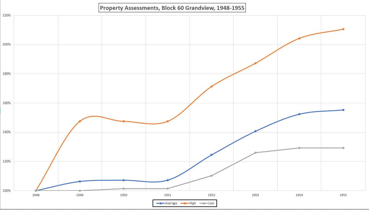

In 1948, the vacant lot assessments ranged from a low of $460 to a high of $645. The property assessments in the same year ranged from $960 to $2,660.
