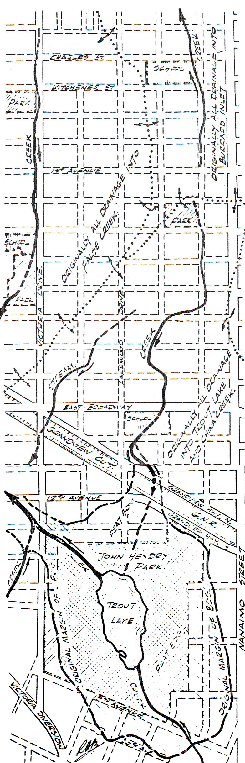
While researching through the old “Highland Echo” editions today, I came across this map of streams and creeks that had formerly traversed Grandview.
 Obviously I cannot verify the accuracy of this map. However, it was prepared by Roy Blunden of the Dept of Geological Sciences at UBC in preparation for a geological map of BC. It was published in the “Highland Echo” of 9th March, 1978.

There are low spots on the landscape, such as a swale on Adanac just west of Nanaimo, where houses were built on creekbeds or bogs; you can see the brick walls tipping and sinking and the houses don’t look quite level. And new development – the new, deeper basements – sometimes cause surprises. The new house built next door to us on Venables near Lakewood uncovered a trickling stream that became quite a lake during the dry spell when the excavation sat open. No wonder the smart builders a century ago only took off the organic, the top foot or so, to put in their foundation footings; the building code and zoning of the time helped them, as any floorspace more than a foot below grade was not counted.
LikeLike
If anyone has confirmation of the existence of the creeks shown on the map, please post a comment about it. I am not aware of any other maps showing these creeks, and wonder if this map is just based on a contour map and shows where creeks would have been if they existed…
LikeLike
I doubt if this was a speculative map. Roy Blunden who created the map specifically states that it “shows the course of former creeks in the area.” He also asked — back in 1978 — for assistance in locating other creeks and “information about what materials were used to fill them in.” I’m sure UBC Geology has the archives from this time and could give a categorical response.
LikeLike